Maritime data: big data source with great potential
Detailed real time data
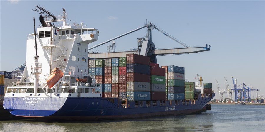
The AIS system was introduced in 2003 and was developed to improve maritime safety conditions. Ships send signals to each other and from ship to shore at regular intervals, with information including their position and speed. This unlocks large amounts of data, which is a potentially huge source of information once it has been made suitable for statistical use. ‘Based on this detailed data we can determine, for example, which ship type ties up where, and how long it is berthed in each port’, says policy advisor Anke Consten, who leads the European project group on behalf of CBS.
CO2 emissions from ships
Apart from enrichment of existing data, the project group is also setting course for the development of new statistical products. ‘In phase two, we will work on statistics related to ships’ emissions of CO2’, says Consten. The project – a cooperative framework with the NSIs of Denmark, Norway, Poland and Greece – is part of the European ESSnet Big Data, a project funded by the European Union in which NSIs conduct joint research on the possibilities of implementing big data for official statistics production.
‘The purpose of this study: to improve on existing maritime statistics and allow common use of AIS data in the production of official statistics throughout Europe in the near future’
Shipping routes
The study – launched in February 2016 – is making headway according to Tessa de Wit, a statistical researcher in the Traffic and Transport Statistics department at CBS. ‘We work closely with Marco Puts, a data scientist at the Center for Big Data Statistics (CBDS), which was established by CBS in September 2016. We expect to have a first visualisation ready in a couple of weeks, which will show the ships docking at the Port of Amsterdam. The second visualisation will be on shipping routes and is due to come out at the end of July this year.’
Data as economic indicator
Due for completion in May 2018, the study will yield many insights as foreseen by the two CBS experts. ‘We’ll have a huge amount of detailed data at our disposal and this will allow us to perform numerous analyses’, says Consten. ‘For instance, we will know more about the destination of ships departing from Dutch ports.’ The data is furthermore likely suitable to serve as an economic indicator. ‘For example, we can monitor developments in the transportation and destination of certain goods’, de Wit explains. ‘Based on patterns, we will be able to draw international comparisons at short notice. This means we can keep abreast of a rising number of container ships calling on the Port of Rotterdam, for example. In the past, we often had to wait for reports from various countries to come in; thanks to the AIS data, international information can be taken directly from a single source. It is a truly European project.’