Which types of ecosystems exist?
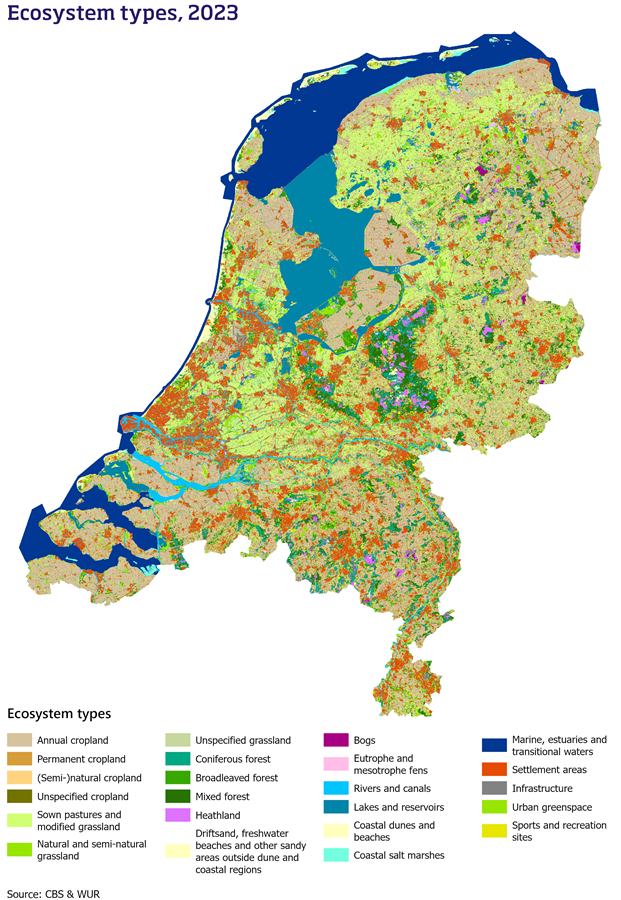
The natural capital accounts study the existence and extent of various ecosystems in the Netherlands. They also track the changes in these ecosystems over time. To support this, Statistics Netherlands (CBS) develops the ecosystem type map. This map divides the entire country into distinct types of ecosystems. These include the built environments, urban green spaces, croplands, grasslands, forests, dunes and beaches, wetlands and peatlands, rivers and canals, lakes and reservoirs, and marine ecosystems. Each main ecosystem type is further divided into sub-ecosystems to create a detailed overview of the diverse set of ecosystems in the Netherlands.
The Dutch ecosystem type map enables the development of several indicators. These indicators provide insights into the extent and changes of Dutch ecosystems:
- Extent per ecosystem type: shows the size and distribution of the natural, agricultural, and (semi-)built ecosystems.
- Changes and conversions: Tracks shifts in land use and vegetation over time, for example measuring how a decline in grasslands relates to urban development or the creation of new natural areas.
- Ecosystem services: identifies where specific ecosystem services are provided, such as timber production, air filtration, or opportunities for recreation in nature.
Related items
- External link Maps - Atlas Natural Capital
- Link Statline – Ecosystem extent account